Applying Criterion B - Restricted Geographic Range
Criterion B identifies populations with restricted distributions that are also severely fragmented or occur in a small number of locations, are experiencing continuing decline, or are exhibiting extreme fluctuations. Taxa with very large ranges will generally have a lower risk of extinction than a species with a highly restricted distribution, which is likely to be more at risk from localised threats.
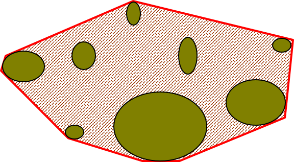
Two of the metrics within criterion B that are used for identifying these restricted distributions are Extent of Occurrence (EOO) and Area of Occupancy (AOO). Extent of Occurrence is the area within the shortest continuous imaginary boundary drawn around all known, inferred, or projected sites presently occupied by the taxon. It is not the species range and is drawn as minimum convex polygon around the limits of a species known range.

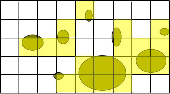
Area of Occupancy is the area within the extent of occurrence that is actually occupied by the taxon. It is measured by overlaying a 2x2 km grid and counting the number of occupied cells.

Both these metrics require georeferenced locality data and GBIF-mediated data can be used for calculating both EOO and AOO of species. A number of tools have been developed for calculating these measurements including ArcGIS toolboxes, the R package red and GeoCat. The latter provides users with little programming or GIS experience, the ability to take GBIF-mediated data and calculate EOO and AOO measurements.