 Improve this document
 Create an issue
 Edit on GitHub
Mapping standards for IUCN Red List Assessments
All assessments should be accompanied by a distribution map. Maps are included on the Red List for several reasons. Primarily, the maps provide a visual representation of the taxon’s distribution, so people can see where the taxon is found and help to identify priority areas for conservation and inform conservation policy. Different mapping standards are applied for different taxonomic groups and for whether the species is terrestrial, marine or freshwater. Full guidance on the application of these standards can be found on the IUCN Mapping Standards webpage.
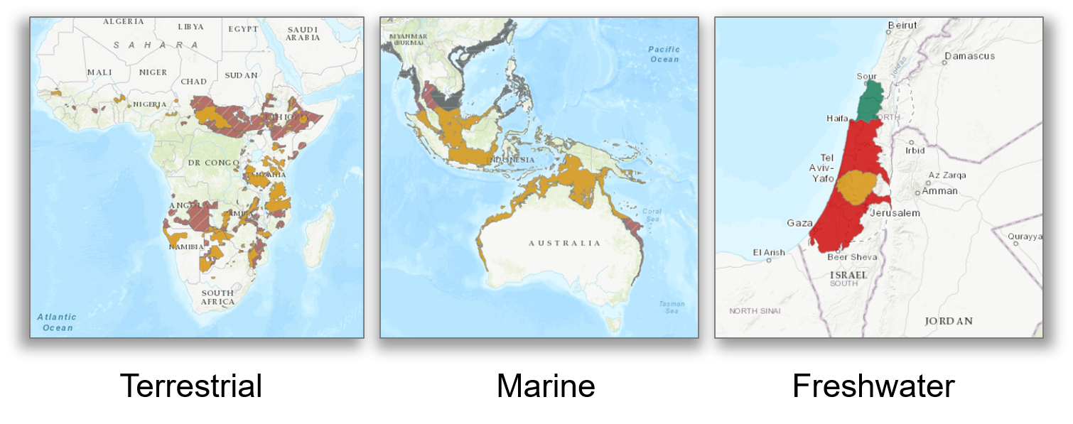
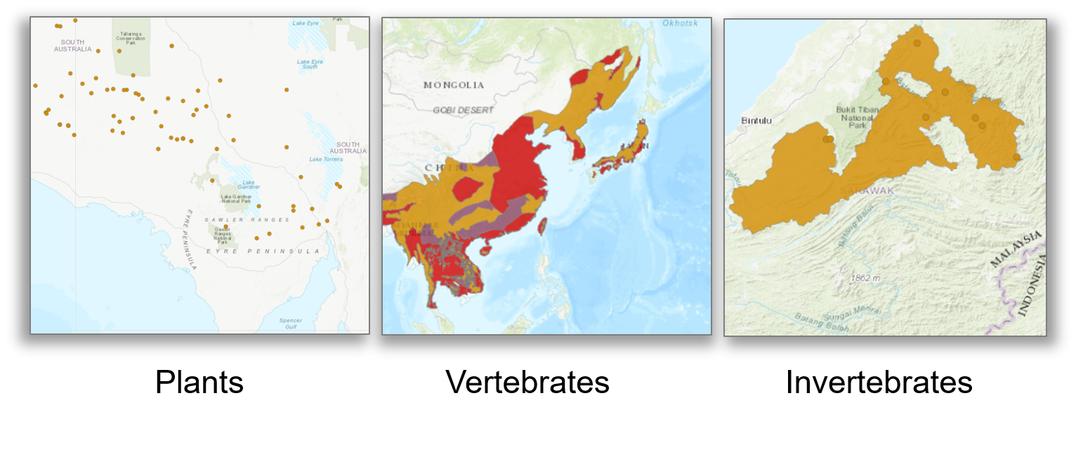
In many cases the distribution is depicted as polygons, but it may also be represented by data points (collection records), or a mixture of points and polygons. Polygon maps, commonly referred to as “limits of distribution” or “field guide” maps, aim to provide the current known distribution of the species within its native range i.e. the species probably only occurs within that polygon. The taxon may not be distributed equally within that polygon or occur everywhere within that polygon. These limits of distribution are determined by using known occurrences of the species, along with knowledge of habitat preferences, remaining suitable habitat, elevation limits, and other expert knowledge of the species and its range.
Minimum Documentation
Assessors should provide with their maps, whether they are points, polygons or a combination of both, a set of accompanying attributes i.e. data attached to points and polygons. Some of these attributes are required as part of minimum documentation supporting assessments. A full overview of these minimum documentation requirements can be found in the mapping standards guidelines on the IUCN Mapping Standards webpage. You can also find a a downloadable Excel file at the above link where attribute fields have been mapped to Darwin Core fields to highlight those fields in your GBIF downloads that fulfil minimum documentation requirements when submitting Red List assessment maps.