Improve this document
 Create an issue
 Edit on GitHub
Data cleaning step 2
Flagging records with problematic occurrence information using functions of the coordinatecleaner package.
clean_step2 <- clean_step1 %>%
  filter(!is.na(decimallatitude),
         !is.na(decimallongitude),
         countrycode == "MG") %>% # "MG" is the iso code for Madagascar
  cc_dupl() %>%
  cc_zero() %>%
  cc_equ() %>%
  cc_val() %>%
  cc_sea() %>%
  cc_cap(buffer = 2000) %>%
  cc_cen(buffer = 2000) %>%
  cc_gbif(buffer = 2000) %>%
  cc_inst(buffer = 2000)
print(paste0(nrow(gbif_download)-nrow(clean_step2), " records deleted; ",
             nrow(clean_step2), " records remaining."))
Plotting raw records vs. cleaned records (step 2)
ggplot() +
  geom_sf(data = world_map) +
  geom_point(data = gbif_download,
             aes(x = decimallongitude,
                 y = decimallatitude),
             shape = "+",
             color = "black") +
  geom_point(data = clean_step2,
             aes(x = decimallongitude,
                 y = decimallatitude),
             shape = "+",
             color = "red") +
  theme_bw()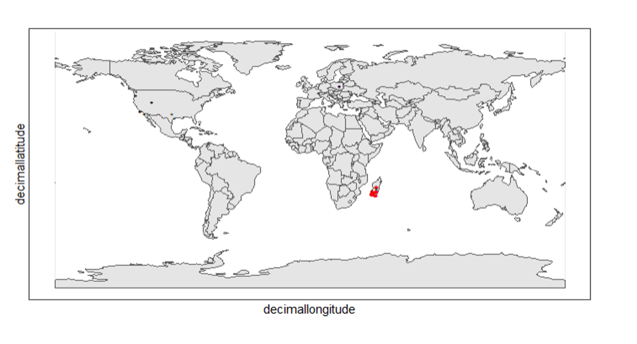
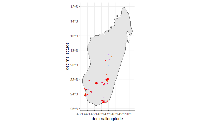
The black "" markers indicate the occurrences of the raw dataset; whereas the red "" markers indicate the occurrences of the cleaned dataset.
Zooming in to madagascar
ggplot() +
  geom_sf(data = country_map) +
  geom_point(data = gbif_download,
             aes(x = decimallongitude,
                 y = decimallatitude),
             shape = "+",
             color = "black") +
  geom_point(data = clean_step2,
             aes(x = decimallongitude,
                 y = decimallatitude),
             shape = "+",
             color = "red") +
  coord_sf(xlim = st_bbox(country_map)[c(1,3)],
           ylim = st_bbox(country_map)[c(2,4)]) +
  theme_bw()