 Improve this document
 Create an issue
 Edit on GitHub
Exercise 12 - Calculating Environmental Similarity
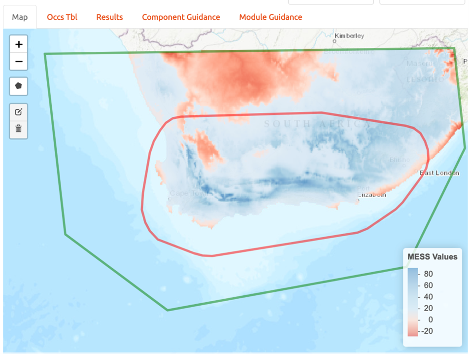
MESS analyses allow us to characterize the degree to which the model projection region differs from the bioclimatic conditions of the model calibration region.
a) Under “Project Model: Modules Available” select the “Calculate Environmental Similarity” radio button.
b) Press the “Calculate MESS” button under “Calculate MESS for current extent”. Be patient; this process can take a fair bit of time depending on the geographic extent and spatial resolution of your data.
c) Look at the resulting map. What stands out most? High positive values indicate increasing similarity with the conditions used to train the model, and low negative values indicate increasing difference relative to the model calibration bioclimatic conditions.
d) Save MESS evaluation. Under the “Select download file type” dropdown menu, select “GeoTIFF”. Then press “Download”. Save the file to your working project folder. NOTE: The file name automatically generated by Wallace is the exact same as the file name produced for the model training and projection files (the format includes the feature class selection of the model, the model number, and the selected threshold). As such, be sure to add “_MESS” to the end of the file name. For example, the file name for the example provided here would be “LQHP_2_thresh_mtp_MESS.asc”.